How Twitter is helping one Indian city map monsoon floods

Researchers are using tweets from residents to boost Mumbai's response to worsening floods.
Image: REUTERS/Francis Mascarenhas
Stay up to date:
Technological Transformation
- Climate change is fueling more extreme rainfall events, leading to worsening flood-related disasters.
- A research institute in Mumbai, India, is asking residents to tweet details about floods in their neighbourhoods.
- The data will be used to issue geographically specific flood alerts in real-time.
- Researchers hope it will boost the city's flood response by making forecasting more accurate and improving emergency response and rescue efforts.
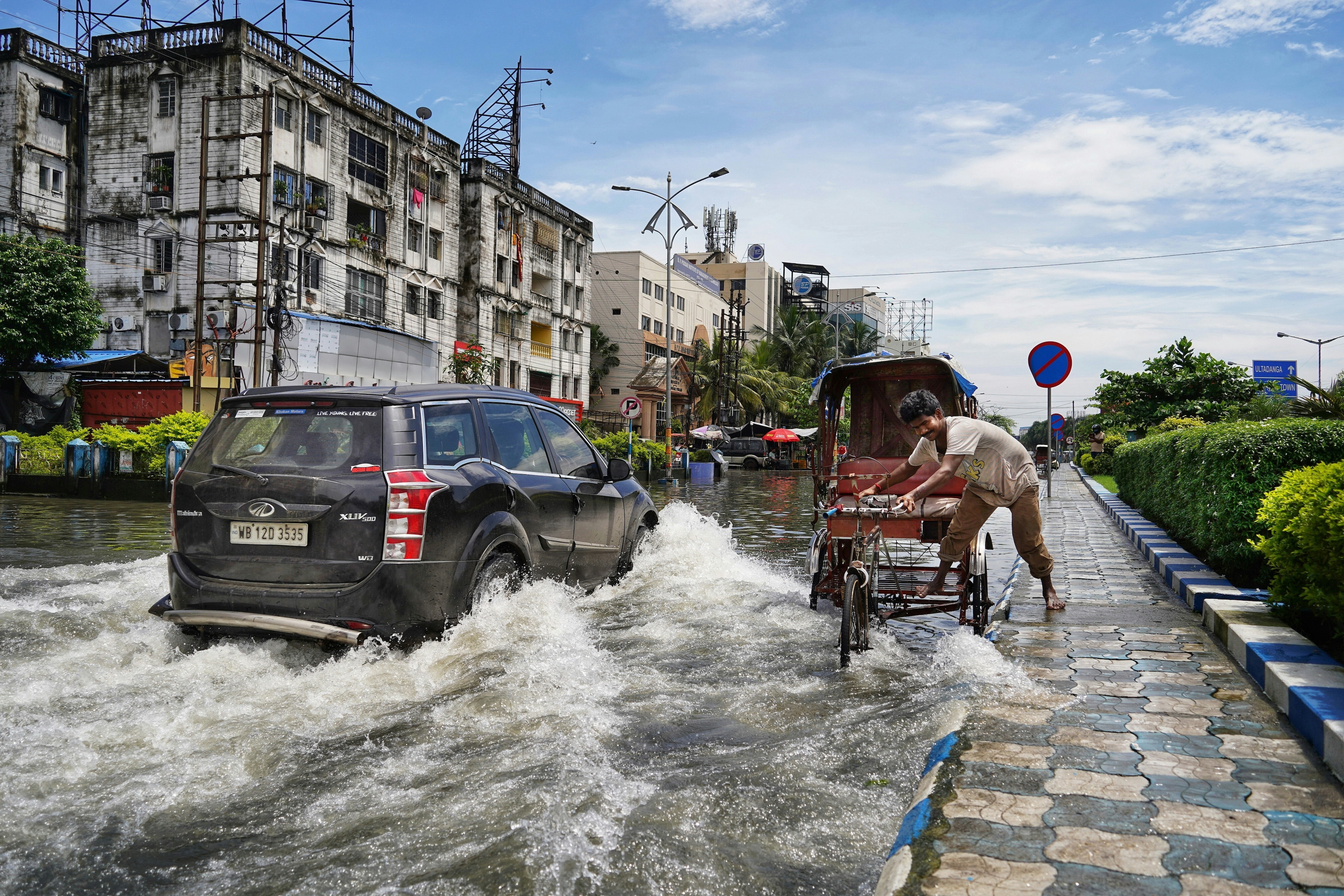
When India’s monsoon rains sweep into Mumbai each year, residents of the financial hub find their social media feeds awash with flood memes - from Venetian gondolas plying the city's deluged streets to office workers commuting on inflatable dinghies.
This year, a research institute hopes social media can play a more practical role - asking residents to tweet details about floods in their neighbourhoods and using the data to issue geographically specific flood alerts in real-time.
"Since we cannot monitor flooding across the city ourselves, we thought of taking the help of the community," said Subimal Ghosh, head of the Climate Studies department at the Indian Institute of Technology Bombay, which is behind the initiative.
Around the world in countries including Australia and Indonesia, climate researchers are increasingly using data gathered via social media to help monitor weather events such as floods.
They say the data could be used to improve emergency response and rescue efforts and make forecasting more accurate, which will become all the more vital as climate change fuels extreme weather.
"We need participatory models for climate adaptation as we will be hit by more extreme rainfall events in the near future. We will be able to show real-time flooding like Google Maps shows red for traffic," said Ghosh.
India's financial capital, which lies on the coast of the Arabian Sea, has recorded "extreme" rainfall - defined as more than 200 mm (7.9 inches) of precipitation in 24 hours - about a dozen times between 2017 and 2021, civic data shows.
That is double the number of such events during the previous five-year period.
The IIT-Bombay project, launched in June just ahead of the monsoon, will use digital elevation maps that show an area's height above sea level, spatial rainfall data along with the tweets of local residents.
Tweets noting "ankle-deep" or "knee-deep" water, for example, will be harvested from Twitter using an automated system that will try to extract flood depth and location information from them.
This will be used to give real-time flood information for the entire city that will be put out on a portal.
For instance, "which areas need water to be pumped out first, how can the traffic be controlled and how can people reach home?" Ghosh said.
"The city needs a resilience plan," he told the Thomson Reuters Foundation.
AI disaster bots for flood alerts
Similar projects elsewhere have shown how local people can play a part in crafting flood responses or alerts.
When flooding hit Australia's east coast this year, submerging entire towns, Brisbane-based tech startup FloodMapps posted a series of flood maps on its social media accounts, mainly Twitter.
The posts prompted some people to post similar maps of other areas. Others sent photographs of the areas depicted, helping to visualise what the maps were showing, a FloodMapps spokesperson said.
"People have reached out to others to alert them to flood conditions," the spokesperson added in emailed comments.
How has the World Economic Forum helped initiate a more effective response to natural disasters and humanitarian crises?
In one case, a business owner was able to warn his staff to stay at home after he saw the map alongside a photo from a neighbour, the company said.
In Indonesia, a local website founded about a decade ago, PetaBencana.id (which means disaster map), is using artificial intelligence (AI) and bots to map disasters in real time.
The prize-winning platform asks people to verify their social media posts with geotagged photos and then combines official data to build up-to-the-minute, online flood maps that "have been used by millions of residents", the platform's founder, Nashin Mahtani, said recently.
Low-income neighbourhoods
South and East Asia are home to nearly 1.36 billion of the 1.46 billion people at risk from flooding around the world, with India and China accounting for a third of them, according to the World Bank.
Low-income neighbourhoods are worse-affected by floods, particularly in cities like Mumbai that have a large population living in informal settlements, the World Bank report states, pointing to poor drainage and land-use planning as key factors.
While the city launched a flood forecasting system two years ago and installed massive drainage pumps in low-lying areas, storm-related disasters such as building collapses and landslides are common in the monsoon months, researchers said.
In recent weeks, floods have hit Bangladesh and northeast India, killing more than 25 people in India's Assam state and leaving millions stranded with little food and drinking water in both countries.
"Flooding is an unavoidable reality, and what we are not able to do is minimise the damage caused by floods," said Prasoon Singh, lead with Center for Global Environment Research of New Delhi-based The Energy and Resources Institute (TERI).
"(But) crowdsourcing information can validate forecasts, help tweak predictions and improve relief and rescue operations," he said, adding that information garnered on social media could also be fed into historical data sets.
In the short term, Ghosh said he hoped the Mumbai project would help city residents go about their daily business - even during the monsoon season.
"My daughter was in school when it started raining heavily and buses were stranded on flooded roads. All the parents were worried and we didn't know how to reach the school through water logged roads," he said.
"Real-time information is important."
Accept our marketing cookies to access this content.
These cookies are currently disabled in your browser.
Don't miss any update on this topic
Create a free account and access your personalized content collection with our latest publications and analyses.
License and Republishing
World Economic Forum articles may be republished in accordance with the Creative Commons Attribution-NonCommercial-NoDerivatives 4.0 International Public License, and in accordance with our Terms of Use.
The views expressed in this article are those of the author alone and not the World Economic Forum.
Related topics:
Forum Stories newsletter
Bringing you weekly curated insights and analysis on the global issues that matter.
More on Climate ActionSee all
Michael Fröbel and Stanislas Hillen
August 8, 2025
Elizabeth Henderson and Daniel Murphy
August 8, 2025
De Rui Wong and Keebum Kim
August 7, 2025
Aurora Matteini and Derek Baraldi
August 6, 2025
Tom Crowfoot
August 5, 2025
Sverre Alvik
August 5, 2025
